When wildfires happen, we use models to predict how they’ll spread, but those models are missing some critical information.
Like how wildfires can make themselves stronger by changing the weather.
Without understanding how wildfires literally make themselves worse, we could be putting people and property in danger, especially as the climate crisis intensifies.
As our climate changes, many parts of the world are expected to undergo warmer Springs and longer summer dry seasons.
That means forested areas are more likely to dry out, which means fire danger increases.
That will make it easier for fires to start.
What’s more, with more people moving into Wildland areas, those fires are more likely to put human life at risk.
Fighting wildfires can be way more difficult than fighting house fires.
Wildfires often start in remote areas and can become massive very quickly.
That means, in order to fight fires safely, firefighters need to know how, when, and where any individual fire is likely to spread.
To figure that out, they use complex computer models which take into account the type of terrain the fire is burning in and how much fuel the fire has access to.
In our current wildfire landscape, though, that just isn’t good enough.
That means we’re going to have to figure out what else affects wildfires so that we can update our models.
And one of the most important factors we need to consider is the weather.
The big issue is wind.
Well, strong winds can snuff out small fires, they only enhance larger fires by literally fanning the flames.
And fires are likely to travel in the same direction as the prevailing wind patterns can push fires in one direction, keep them in place for longer, or even split them into two separate fires.
But while we do incorporate wind forecasts into our models, those forecasts look at how wind blows on a large scale, think atmospheric fronts or enormous storm systems.
They don’t look at wind patterns on small scales, like how wind can curve around a mountain or how a narrow path between two peaks can become a wind tunnel.
That happened in the Redwood Valley fire in 2017.
Weather models didn’t take into account a tiny 11 kilometer gap in the mountains of Northern California, but the wind did.
Winds rushed through the gap, creating a small wind tunnel that carried the fire along with it.
Again, in 2018, winds coming downslope from the nearby mountains pushed a fire into the town of Paradise, California, killing 85 people and virtually destroying the town.
Wind can also pick up embers and carry them far away from the main fire.
If those embers find the right conditions, they can flare up into new wildfires.
That means an updated fire model will have to pay attention not only to which way the wind is blowing but where embers could land and whether those embers are likely to form new fires.
And those are just existing weather conditions.
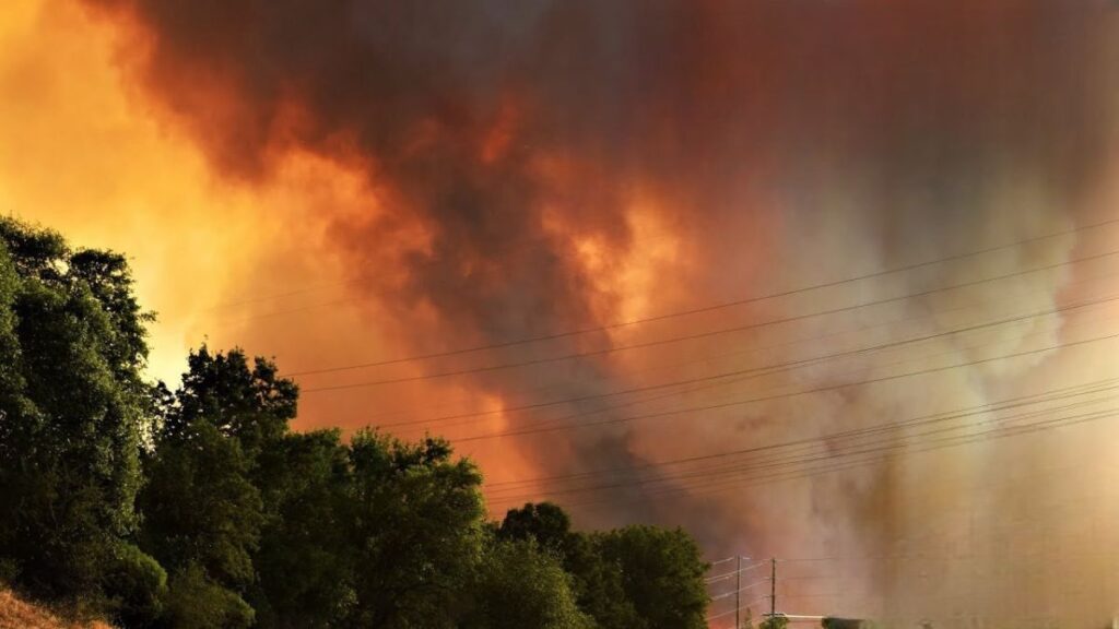
Strong enough fires can also change the weather in their favor.
Fires cause plumes of hot air and smoke to rise, and when the fire is large enough, those plumes can get pretty far into the atmosphere.
When the plumes hit cooler air in the high levels of the atmosphere.
When wildfires happen, we use models to predict how they’ll spread, but those models are missing some critical information like how wildfires can make themselves stronger by changing the weather.
Without understanding how wildfires literally make themselves worse, we could be putting people and property in danger, especially as the climate crisis intensifies.
As our climate changes, many parts of the world are expected to undergo warmer springs and longer summer dry seasons.
That means forested areas are more likely to dry out, which means fire danger increases.
That will make it easier for fires to start.
What’s more, with more people moving into wildland areas, those fires are more likely to put human life at risk.
Fighting wildfires can be way more difficult than fighting house fires.
Wildfires often start in remote areas and can become massive very quickly.
That means in order to fight fires safely, firefighters need to know how, when, and where any individual fire is likely to spread to.
To figure that out, they use complex computer models which take into account the type of terrain the fire is burning in and how much fuel the fire has access to.
In our current wildfire landscape, though, that just isn’t good enough.
That means we’re going to have to figure out what else affects wildfires so that we can update our models, and one of the most important factors we need to consider is the weather.
The big issue is wind.
Well, strong winds can snuff out small fires; they only enhance larger fires by literally fanning the flames, and fires are likely to travel in the same direction as the prevailing wind patterns.
Can push fires in one direction, keep them in place for longer, or even split them into two separate fires.
But while we do incorporate wind forecasts into our models, those forecasts look at how wind blows on a large scale, think atmospheric fronts or enormous storm systems.
They don’t look at wind patterns on small scales like how wind can curve around a mountain or how a narrow path between two peaks can become a wind tunnel.
That happened in the Redwood Valley fire in 2017.
Weather models didn’t take into account a tiny 11-kilometer gap in the mountains of Northern California, but the wind did.
Winds rushed through the gap, creating a small wind tunnel that carried the fire along with it.
Again, in 2018, winds coming downslope from the nearby mountains pushed a fire into the town of Paradise, California, killing 85 people and virtually destroying the town.
Wind can also pick up embers and carry them far away from the main fire.
If those embers find the right conditions, they can flare up into new wildfires.
That means an updated fire model will have to pay attention not only to which way the wind is blowing, but where embers could land and whether those embers are likely to form new fires.
And those are just existing weather conditions.
Strong enough fires can also change the weather in their favor.
Fires cause plumes of hot air and smoke to rise, and when the fire is large enough, those plumes can get pretty far into the atmosphere.
When the plumes hit cooler air in the high levels of the atmosphere, they cool down.
Water vapor condenses out of them, forming storm clouds.
These clouds are common enough features of large fires that they have their own name.
Usually, they’re referred to as pyrocumulonimbus clouds.
Unfortunately, unlike most storm clouds, these clouds don’t tend to release a lot of rain.
And when they do, it can sometimes make fires worse.
When rain falls into dry air, it evaporates, creating a sudden burst of cooler air.
This change can affect the wind patterns, creating downbursts around the flames.
These downbursts can spread embers, causing new ignitions farther.
The simulations they produce line up with how the fires actually spread in reality.
It’s not that far of a stretch to go from that to predicting how future fires will develop.
As these models grow to take into account more and more parameters, it won’t be long until they can be used in real time in a wildfire situation.
This could be life-saving, and we’re going to need these updated models now more than ever.
Even if we act aggressively to cut carbon emissions, we have to accept that even if we stopped burning fossil fuels today, climate change is already here, which means learning how to survive in a changed world with more frequent, more intense wildfires, and hopefully keeping more people safe.